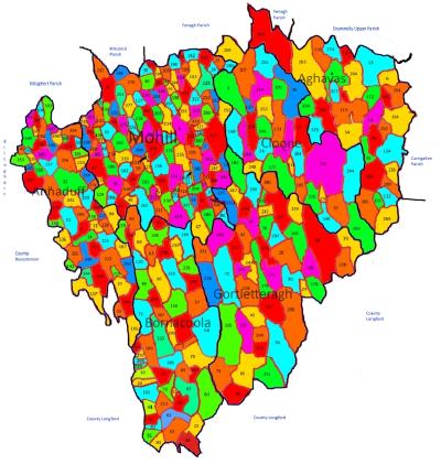
Overview of In-Scope Parishes
The overall map (click image below) shows the 6 Parish areas and their townlands, as well as outlining the borders of surrounding County Leitrim Parishes and surrounding counties.
On the map each in scope Parish is named. To see a more specific map of any of these parishes hover over the Parish Name and click to open up the Parish specific map.
Otherwise, on the overall map the townlands are crudely outlined and are all numbered. Listings of the townlands are shown on separate pages in two sortations. To see the townland details while keeping the map in view it is best, if possible, to open either or both listings in new tabs/windows while keeping the map open. Townlands sorted by Name shows the townlands in Alphabetical order while Townlands sorted by Code Number lists them by their map numbers.